


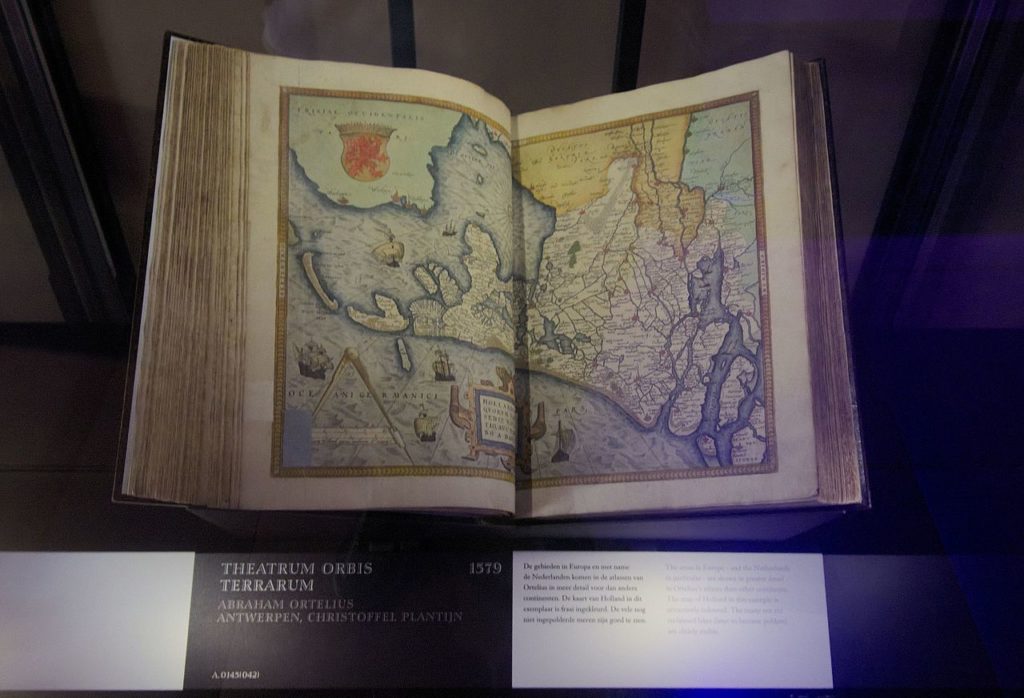
Theatrum Orbis is considered to be the first true modern atlas. Written by Abraham Ortelius, strongly encouraged by Gillis Hooftman, and originally printed on 20 May 1570 in Antwerp, it consisted of a collection of uniform map sheets and supporting text bound to form a book for which copper printing plates were specifically engraved.
The Ortelius atlas is sometimes referred to as the summary of sixteenth-century cartography. The publication of the Theatrum Orbis Terrarum (1570) is often considered the official beginning of the Golden Age of Netherlandish cartography (approximately 1570s–1670s).
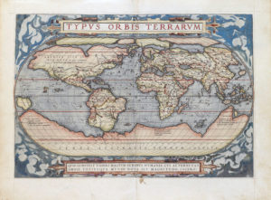
The atlas contained virtually no maps from the hand of Ortelius, but 53 bundled maps of other masters, with the source as indicated. Previously, groupings of disparate maps were only released as custom lots, in individual orders. In the Ortelius atlas, however, the maps were all in the same style and of the same size, printed from copper plates, logically arranged by continent, region, and state. In addition to the maps, he provided a descriptive comment and referrals on the reverse. This was the first time that the entirety of Western European knowledge of the world was brought together in one book.
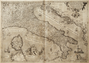
This work by Ortelius consisted of a collection of the best maps, refined by himself, combined into one map or split across multiple, and on the same size (folios of approximately 35 x 50 cm). The naming and location coordinates were not normalized.
According to Wikipedia
 Poggenpohl: World’s oldest kitchen brand")
 Longleat Hedge Maze: World’s largest yews maze")
 Irish Parachute Club: Oldest parachute club")
 Litografia Bulla: Oldest surviving lithography workshop in the world.")