


Cape Raoul is a rural locality and a natural feature in the local government area of Tasman in the South-east region of Tasmania. It is located about 13 kilometers south of the town of Nubeena. The 2016 census determined a population of nil for the state suburb of Cape Raoul.

The cape features rock platforms, towering cliffs, columns, and off-shore islands. There is a 300-meter-high cliff with scenic views of the coastline. A 7-kilometer walking track there then descends steadily onto the Cape Raoul plateau, with the spectacular cape of dolerite columns at the end of the plateau.
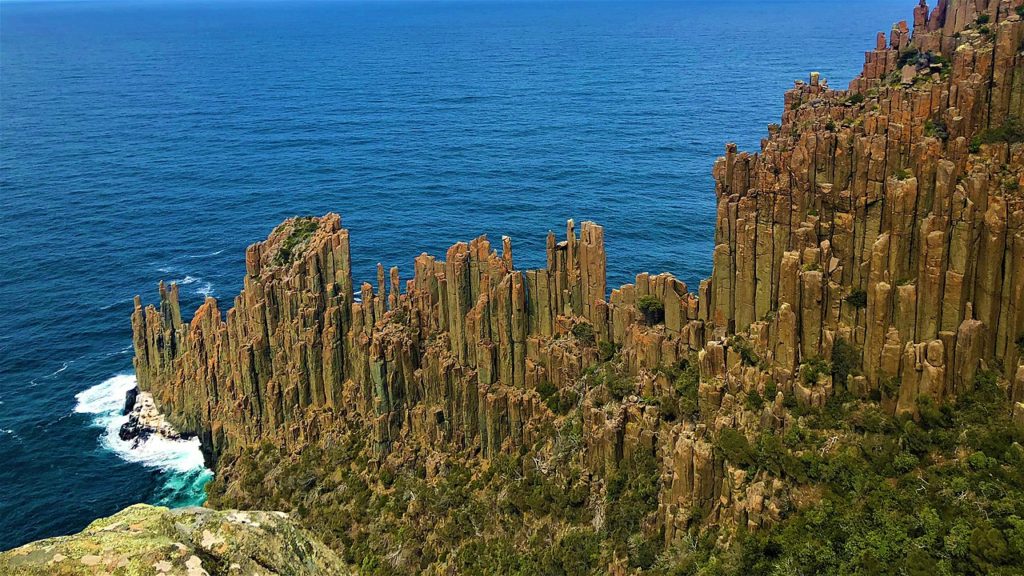
The columns at the cape appear to be a colonnade formed from columnar jointing. This happens when a pool of magma cools at just the right rate so that as its surface contracts, it cracks into polygonal plates. The cracks accelerate the cooling, extending the cracks vertically, and thereby forming columns.
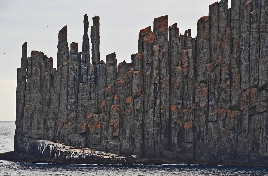
Dolerite columns cluster together at the Raoul cape to create a structure like a solitary fortress facing the great sea in myths.
 Mont Ventoux: Paradise for cyclists")
 Sucre: A captivating destination of Bolivia")
 Lakagígar: Dramatic landscape of Iceland")
 Selkirk Loop: Discover the majestic beauty of the Selkirk Mountains")
