


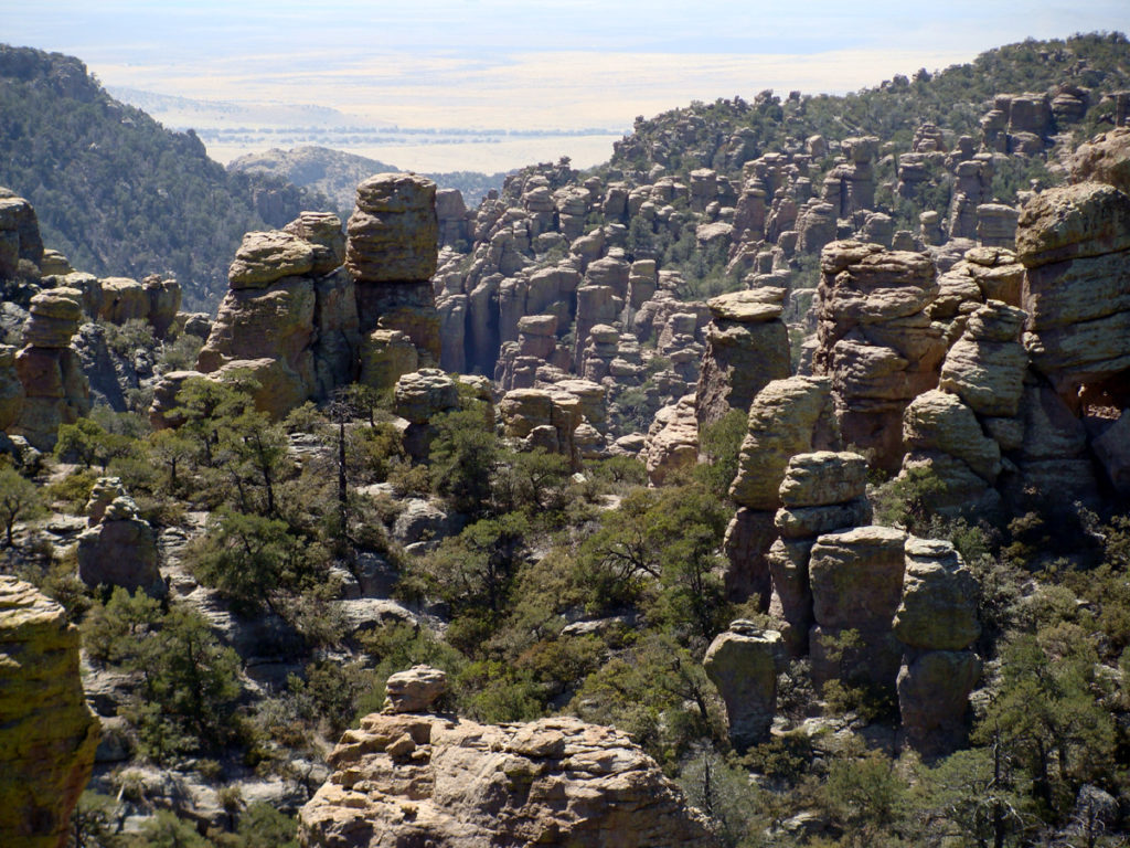
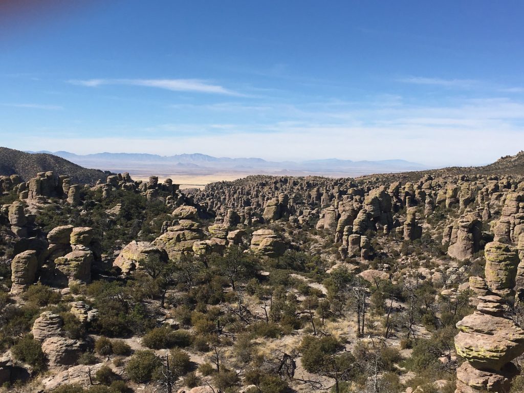
Chiricahua National Monument, a wilderness of unusual volcanic rock formations -tall and slender pinnacles crowded into 49 square km of ridge and canyon on the west flank of the Chiricahua Mountains – in southeastern Arizona, U.S.
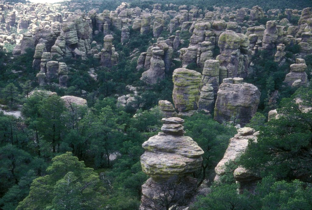
By far the most noticeable natural features in the park are the rhyolite rock pinnacles for which the monument was created to protect. Rising sometimes hundreds of feet into the air, many of these pinnacles are balancing on a small base, seemingly ready to topple over at any time.
The geologic features of the park include shallow caves, faults, mountain formations, ancient lava flows, and a giant volcanic caldera. The Turkey Creek Caldera is located just to the south of the park.
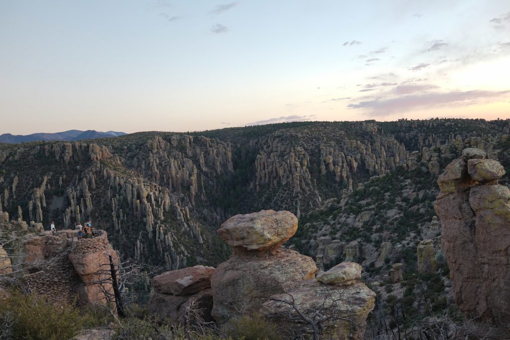
A cataclysmic volcanic eruption, roughly 27 million years ago, spewed ash and molten debris at super-sonic speeds and formed the approximately 12-mile-wide caldera. Ash and debris settled and compacted, forming a thick layer of rock called rhyolite tuff. This rock layer has fissured and eroded over time, forming the spectacular rock pillars of the Chiricahua National Monument.

An important natural feature found in the park, and integral to the presence of flora and fauna, is water. Rich in diversity, the monument boasts many plant communities, including grasslands, deciduous and evergreen forests, scrublands, and deserts. These plant communities intermix throughout the monument, creating a truly diverse mosaic of species associations.
According to the Internet
 Gruta do Lago Azul: The blue wonder of Brazil")
 Pikes Peak Highway: Scenic road in the American West")
")
 Salar de Huasco: The beauty of Chile’s highland")
