


El Alto is the second-largest city in Bolivia, located adjacent to La Paz in Pedro Domingo Murillo Province on the Altiplano highlands. El Alto is today one of Bolivia’s fastest-growing urban centers, with an estimated population of 943,558 in 2020, It is also the highest major city in the world, with an average elevation of 4,000 m.
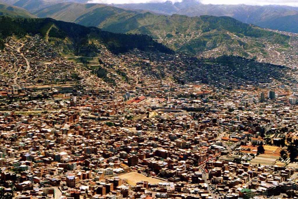
The dry and inclement plain above La Paz was uninhabited until 1903 when the newly built railways from Lake Titicaca and Arica reached the rim of the canyon, where the La Paz terminus, railyards, and depots were built along with a settlement of railway workers (a spur line down into the canyon opened in 1905). In 1925, the airfield was built as a base for the new air force, which attracted additional settlement. In 1939, El Alto’s first elementary school opened. El Alto started to grow tremendously in the 1950s when the settlement was connected to La Paz’s water supply.
The El Alto–La Paz metropolitan area, formed by La Paz, El Alto, Achocalla, Viacha, and Mecapaca, constitutes the most populous urban area of Bolivia, with a population of about 2.2 million.
El Alto is connected to La Paz by three lines of the Mi Teleférico system. The city is connected to domestic and international destinations by El Alto International Airport.
The city contains La Paz’s El Alto International Airport. El Alto is the highest major city in the world, up to 4,150 meters above mean sea level. It has a cold climate, with the highest average monthly maximum temperature being 17 °C (63 °F) in November. It is one of the fastest-growing cities in Bolivia, due to immigration from Bolivia’s rural areas to the La Paz region which started with the rural reform of 1952 and increased in the last 10 years. Some migrants say the difficulty of growing crops in the countryside drove them to move to the city.
According to Wikipedia
 Underwater Hockey World Championships: World’s oldest underwater hockey world championship still in operation")
 Elgin and Winter Garden Theatres: Oldest surviving Edwardian stacked theatres in the world")
 Caicos Conch Farm : The world’s only commercial conch farm")
 NEPTUNE: World’s largest undersea observatory")
 Macusani Banco de la Nación: World’s highest altitude bank branch")