


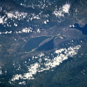
Lake Enriquillo (Spanish: Lago Enriquillo) is a hypersaline lake in the Dominican Republic located in the southwestern region of the country. Its waters are shared between the provinces of Bahoruco and Independencia, the latter of which borders Haiti. Lake Enriquillo is the largest lake in both the Dominican Republic and Hispaniola, as well as the entire Caribbean. It is also the lowest point for an island country.
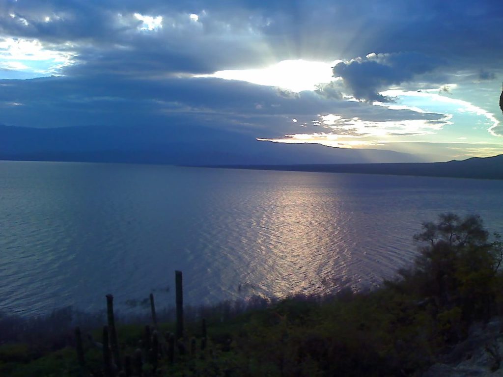
Lake Enriquillo covers an area of 145 mi2 (375 km2), and is the lowest point for an island country, falling 46 m below sea level. Its drainage basin includes 10 minor river systems. The rivers that rise in the Neiba Mountains to the north (lower center and lower right of the image) are perennial. Those rivers that rise in the Baoruco Mountains to the south are intermittent. Lake Enriquillo has no outlet. The lake’s water level varies because of a combination of storm-driven precipitation events and the region’s high evaporation rate. Salinity in the lake can vary between 33 parts per thousand (comparable to seawater) and over 100 parts per thousand (hypersaline).
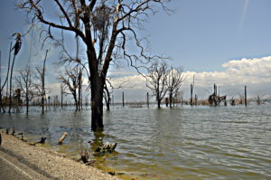
Land near Lake Enriquillo has long been used for agriculture, with crops such as bananas, sweet potatoes, and yuca being grown there, as well as pasture for cattle. The rising water levels have affected hundreds of nearby residents in townships bordering the lake, with abundant loss of agricultural land.
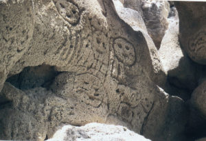
Lake Enriquillo has become an important tourist destination, both for national and foreign tourism. There is a group of possibly pre-Taino indigenous petroglyphs (locally named “las caritas”, “the faces”), from where there is a view of the lake. There are several small hotels in the nearby towns, usually used by travelers linked to commerce, and which are also used by tourists to see the attractions of the area. A transportation system with buses also links this community with Santo Domingo and other communities between them.
According to Wikipedia
 Sucre: A captivating destination of Bolivia")
 Lakagígar: Dramatic landscape of Iceland")
 Selkirk Loop: Discover the majestic beauty of the Selkirk Mountains")

 Bratislava: Historic city of Slovakia")