


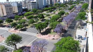
The avenue runs around 3 kilometers to the west of the Río de la Plata waterfront, from the Retiro district in the north to Constitución station in the south. The avenue has up to seven lanes in each direction and is flanked on either side by parallel streets of two lanes each. Through the center of the avenue runs one of the city’s Metrobus (Bus rapid transit) corridors, which stretches 3 kilometers and was inaugurated in July 2013. There are two wide medians between the side streets and the main road. It is currently the widest avenue in the world.
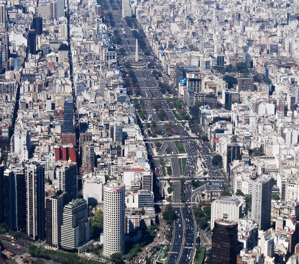
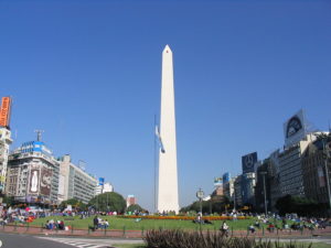
The northern end of the avenue is connected to the Arturo Illia expressway (which connects to Jorge Newbery airport and the Pan-American highway) and to Libertador avenue. The southern end is connected to the 25 de Mayo tollway (serving the west side of Greater Buenos Aires as well as Ezeiza airport) and the 9 de Julio elevated expressway which provides access to the two main southbound roads out of the city (route 1 to La Plata and route 2 to Mar del Plata). Republic Square is located at the intersection of this Avenue with Corrientes Avenue and on that point is sited the Obelisk of Buenos Aires.
The avenue’s unusual width is because it spans an entire city block, the distance between two streets in the checkerboard pattern used in Buenos Aires. The distance between adjacent streets is roughly 110 m, greater than the distance between streets in Manhattan. The street flanking 9 de Julio to the east is called Carlos Pellegrini (north of Rivadavia) and Bernardo de Irigoyen (south of Rivadavia). The street flanking 9 de Julio to the west is called Cerrito (north of Rivadavia) and Lima (south of Rivadavia).
According to Wikipedia
 Uru Uru: The vivid color of a dying lake")

 Prithvi Highway: Dramatic landscape in the route between Pokhara and Kathmandu")
 Yellow River No. 1 Tourist Highway: Driving route along the Yellow River")
 Pink Sands Beach: The unique beach of Harbour Island")