


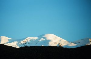
Coropuna is a dormant compound volcano located in the Andes mountains of southeast-central Peru. The upper reaches of Coropuna consist of several perennially snowbound conical summits, lending it the name Nevado Coropuna in Spanish.
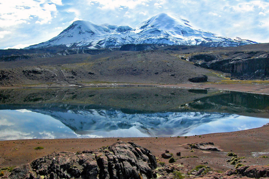
Coropuna’s thick ice cap is the most extensive in Earth’s tropical zone, with several outlet glaciers stretching out to lower altitudes. Below an elevation of 5,000 meters, there are various vegetation belts which include trees, peat bogs, grasses, and also agricultural areas and pastures.
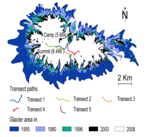
The ice cap of Coropuna, which during the Last Glacial Maximum (LGM) had expanded to over 500 km2, has been in retreat since at least 1850. Estimates published in 2018 imply that the ice cap will persist until about 2120. The retreat of the Coropuna glaciers threatens the water supply of tens of thousands of people relying upon its watershed, and interaction between volcanic activity and glacial effects has generated mudflows that could be hazardous to surround populations. Because of this, the Peruvian geological agency, INGEMMET, monitors Coropuna and has published a hazard map for the volcano.
The Coropuna Ice Cap represents the largest source of freshwater for the region of Arequipa, which relies on snow and ice melt to support its population of over 1 million people.
There is no habitation on Coropuna above 5,200 meters, but numerous villages dot the lower slopes. Agriculture and animal husbandry are the most common economic activities; there are copper and gold mines as well. The city of Arequipa lies 150 km to the southeast.
According to Wikipedia
 Underwater Hockey World Championships: World’s oldest underwater hockey world championship still in operation")
 Elgin and Winter Garden Theatres: Oldest surviving Edwardian stacked theatres in the world")
 Caicos Conch Farm : The world’s only commercial conch farm")
 NEPTUNE: World’s largest undersea observatory")
 Macusani Banco de la Nación: World’s highest altitude bank branch")