


The Fly River is the third longest river on the island of New Guinea, after the Sepik River and Mamberamo River, with a total length of 1,060 km and the largest by volume of discharge in Oceania, the largest in the world without a single dam in its catchment, and overall the 20th-largest primary river in the world by discharge volume. It is located in the southwest of Papua New Guinea and Papua Province of Indonesia. It rises in the Victor Emanuel Range arm of the Star Mountains and crosses the southwestern lowlands before flowing into the Gulf of Papua in a large delta.
The Strickland River is a major river in the Western Province of Papua New Guinea. It is the longest and largest tributary of the Fly River with a total length of 824 km including the Lagaip River the farthest distance river source of the Strickland River.
The Fly-Strickland River system has a total length of 1,220 km making it the longest river system of an island in the world, including 824 km Strickland River is the longest and largest tributary of Fly River, making it the farthest distance source of the Fly River.
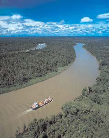
The delta of the Fly River is over 100 km wide at its entrance, but only 11 km wide at the apex upstream of Kiwai Island. The delta contains 3 main distributary channels (the Southern, Northern, and Far Northern Entrances) that branch from a common point (the “apex”). The Fly Delta exhibits a distinctive funnel shape in plan view, attesting to the fundamental role of tidal currents in shaping the Delta’s geomorphology. Mean spring tidal ranges are amplified within the delta, from around 3.5m at the seaward entrance of the distributary channels, reaching a peak of about 5m at the delta apex.
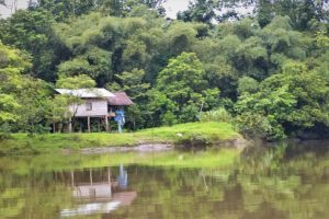
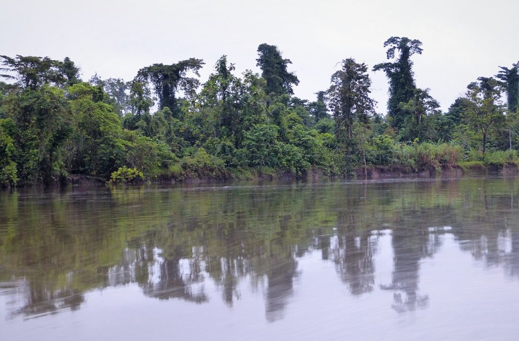
The river delta is studded with low and swampy islands covered with mangroves and nipa palms, with villages and cultivated areas on these islands. The land on both sides of the estuary is of the same character. The islands in the estuary are flat and covered with thick, fertile alluvial soil.
According to Wikipedia
 Royal Flying Doctor Service: World’s oldest aeromedical service")
 Canning Stock Route: The longest historic stock route in the world")
 New Caledonian giant gecko: The largest extant gecko in the world")
 Michael Smith: World’s first person to solo navigate the world in a single-engine flying boat")
 Melbourne University Lacrosse Club: The oldest continuously existing lacrosse club in the world")